

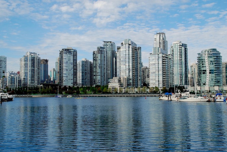
Metro Vancouver is located on the Western seaboard of the North American continent in the South Western part of British Columbia. The province of British Columbia is the most westerly of Canada’s ten provinces, and it’s three territories. There 21 municipalities, which added together make up Metro Vancouver. The total area covered by all of the municipalities is some 2,930 square kilometers in the Fraser River delta, and that includes the City of Vancouver itself. Metro Vancouver as a rough guide is bordered to the North by the Coast Mountains, the U.S border lies to the South, to the West is the Pacific Ocean, and finally to the East are the outskirts of Langley and also Maple Ridge.
On the far Western edge of the peninsula that in its own right acts as an extended part of the River Fraser delta. That delta itself has jutted into the Pacific Ocean, it is the Strait of Georgia , which splits the mainland part of Vancouver from Vancouver Island. The municipalities are self-governing built up and urban locations, which when added together constitute Metro Vancouver. The North Shore lies directly to the North of the City of Vancouver, made up of North Vancouver with West Vancouver. The suburb of Burnaby can be found to the East and Richmond bordering to the South.
The outer limits to the South of the city are bordered by the Northern part of the Fraser River. That river has been one of the largest ones, which flows into the Pacific Ocean. Some 38 kilometers / 24 due South of the most Southern suburbs is the border with the U.S.
 The City of Vancouver
Burrard Inlet is on the northern outskirts of the City of Vancouver, and it is the port for the whole of the city. The water in front of the inlet is known as English Bay. It is the beaches and the sailing that makes English Bay popular with both locals and tourists. Freighters find it useful to stay there when waiting to go into the harbor. English Bay marks the northern edge of the city’s downtown core area and the western edge of other neighbourhoods. The Southern boundary comes in the form of the Fraser River. To the East the border is Burnaby.
The Streets of Vancouver
Streets within the city are arranged on a traditional grid. The only time that is not the case is when there are natural obstacles in the way including larger park areas, hills, and the river. The grid has streets running from North to South while the avenues run from East to West. There are 77 avenues, all of, which were originally numbered all the way from the 1st Avenue through to the 77th Avenue. The 9th Avenue became Broadway, while the 25th Avenue was renamed King Edward Avenue. Elsewhere all of the streets and the roads have been named.
Typically the streets, avenues, and roads are split into blocks of 100 houses. Buildings on avenues are described as been on the East side or West side depending on where they are located. Odd numbered properties are on the North or West sides, while the even numbers are sited on the South and East sides.
Businesses and Shopping in Metro Vancouver
Each of the municipalities within Metro Vancouver has it’s own commercial and shopping areas or centers. For example, on the North Shore, the center of business is in Marine Drive within West Vancouver. In North Vancouver, the Marine Drive continues into Third Street.
Other centers include the Metrotown shopping center and the Fraser River waterfront.
Community Lending Centre – Vancouver mortgage brokers is writing a series of articles that talk about the great city of Vancouver, British Columbia. We hope it provides you with plenty of info to get to know the great city of Vancouver!